wiki.Alumni.NET - Your Location Information Resource
Asia/Philippines/Palawan/El Nido (Bacuit)/Miniloc Island Resort/
From wiki.Alumni.NET
| Line 1: | Line 1: | ||
| + | {{Coord|11|08.971|N|119|19.215|E|display=title}} | ||
[[Image:ElNido-Logo1.gif|right|104px||]] | [[Image:ElNido-Logo1.gif|right|104px||]] | ||
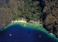
[[Image:ElNido-Miniloc.jpg |right|232px||]] | [[Image:ElNido-Miniloc.jpg |right|232px||]] | ||
| Line 5: | Line 6: | ||
** Address, Directions, & Map | ** Address, Directions, & Map | ||
*** Located in El Nido Bacuit Palawan which is part of [[Asia/Philippines/Palawan/]]. | *** Located in El Nido Bacuit Palawan which is part of [[Asia/Philippines/Palawan/]]. | ||
| - | |||
* Overview | * Overview | ||
| - | |||
El Nido is a municipality located at the northwestern tip of the province of Palawan in the Philippines. It is about 430 kilometers southwest of Manila, and about 238 kilometers northwest of Puerto Princesa, Palawan’s capital. El Nido is bordered by the Linapacan Strait in the north, the Sulu Sea in the east, and the South China Sea in the west. The Municipality of El Nido is composed of 18 barangays (villages) covering a total land area of 50,000 hectares. Its population of 27,000 people, is a mix of native Palaweños, with a heavy presence of migrants from other parts of the Philippines. | El Nido is a municipality located at the northwestern tip of the province of Palawan in the Philippines. It is about 430 kilometers southwest of Manila, and about 238 kilometers northwest of Puerto Princesa, Palawan’s capital. El Nido is bordered by the Linapacan Strait in the north, the Sulu Sea in the east, and the South China Sea in the west. The Municipality of El Nido is composed of 18 barangays (villages) covering a total land area of 50,000 hectares. Its population of 27,000 people, is a mix of native Palaweños, with a heavy presence of migrants from other parts of the Philippines. | ||
Revision as of 10:22, 27 September 2007
Contents |
El Nido Maniloc Island Resort
- Location
- Address, Directions, & Map
- Located in El Nido Bacuit Palawan which is part of Asia/Philippines/Palawan/.
- Address, Directions, & Map
- Overview
El Nido is a municipality located at the northwestern tip of the province of Palawan in the Philippines. It is about 430 kilometers southwest of Manila, and about 238 kilometers northwest of Puerto Princesa, Palawan’s capital. El Nido is bordered by the Linapacan Strait in the north, the Sulu Sea in the east, and the South China Sea in the west. The Municipality of El Nido is composed of 18 barangays (villages) covering a total land area of 50,000 hectares. Its population of 27,000 people, is a mix of native Palaweños, with a heavy presence of migrants from other parts of the Philippines.
El Nido is named after the edible nests of Swiftlets (Collocalia Fuciphaga) found in the crevices of its limestone cliffs. These nests, “nido” in Spanish, are the main ingredient for the gourmet nido soup.El Nido is considered as a showcase of Palawan’s geology and diverse wildlife. Its majestic limestone cliffs stand guard over clear waters, with hundreds of species of tropical fishes and corals, and three species of endangered sea turtles. El Nido’s forests are host to more than 100 species of birds, a large number of which are endemic to Palawan.
The most striking feature of El Nido is its scenic landscape - massive limestone islands of varying shapes and sizes scattered about the sparkling sea.
The limestone cliffs of El Nido were naturally carved out of extensive and thick layers of coralline deposits. They formed 250 million years ago in the shallow sea covering the area that North Vietnam and South China now occupy. These layers slowly rose from the sea as a result of the collision of India and mainland China about 60 million years ago.
Like the rest of Palawan, El Nido is part of the Eurasian Plate, an entirely separate plate from the Philippine Mobile Belt to which the rest of the country belongs. A proof of this fact is that Palawan has no active volcanoes, unlike the rest of the Philippine archipelago. Another is that limestone cliffs similar to those in Palawan can be found in Ha Long Bay in Vietnam and Guilin in China, countries which are part of the Eurasian Plate. It is believed that Palawan was detached from mainland China some 40 million years ago. Palawan drifted southward and linked up with the rest of the Philippines around 15 million years ago.
Visitors
- Positive Feedbacks, Reviews, & Recommendations
- Rooms
- Food
- Facilities
- Service
- Location
- Negative Feedback
- This wiki page is not for writing negative feedbacks about the the establishment. Please use other websites to voice your negative experience.
- Picture Links
Staff
- Prospective Employees
- Job Listing
- Current Employees
- Former Employees (Alumni)
External Links
References


